Google I/O 2011 – The Geo Developers

Google I/O was about the maturation of many of the Geo APIs, this year’s was more about their sophistication, both in the designs discussed and the applications on display. Like the sun standing still at the solstice, let’s take a moment to reflect on recent events and look ahead to the coming season.

Several new features made their debut at I/O this year. The much-anticipated Places API took the stage, as did its companion the Places Autocomplete API. Dynamic Styling was introduced for Fusion Tables layers in the Maps API, allowing layer styling to be defined by the API application via Javascript. Finally, some extremely helpful open source Javascript libraries were introduced to make Maps API development even easier.

Joining us on stage were several developers who came to share their expertise. Justin O’Beirne of 41Latitude talked about map usability and design in the “Designing Maps Applications for Usability” session. The Guardian UK’s Simon Rogers joined us to talk about how the Guardian is using Fusion Tables to visualize the data they collect in “Managing and Visualizing Your Location Based Data.” Yoni Samlan from SCVNGR also came to discuss developing with the Places API in “Location-based App Development.”

In addition to the sessions led by the Geo team, the developer sandbox featured eight Geo API partners who engaged directly with I/O attendees. Joining us in the sandbox were HistoryPin, Icon Fitness, Ubisense, The Wall Street Journal, Footprint Feed, The Bay Citizen, Arc2Earth, and Travel Game. The apps on display ranged from location-based gaming using the Latitude API to tools for citizen journalists to map public data using Fusion Tables. You can learn more about two of our sandbox partners in these video case studies:

  • The Bay Citizen (video) – The Bay Citizen explains the benefits of the Fusion Tables layer with Google Maps API to build infographics for their online newspaper. The Bike Accident Tracker visualizes the prevalence of bike accidents across San Francisco.
  • Historypin (video) – HistoryPin lets users upload historical photos, geotag them on a Google Maps, and overlay the old imagery on top of new Street View imagery, enabling users to see what their cities looked like at different points in time.


Geo APIs Summer Learning Series (apologies to the Southern Hemisphere)

But at the heart of Google I/O are the sessions themselves. This year, speakers from the Maps, Earth, and Fusion Tables teams covered a wide range of topics, from ensuring high performance and usability across all browsers to visualizing huge data sets with Fusion Tables. The amount of material covered was enormous…but we want to expand upon it.

To that end, we’re pleased to announce the “Geo APIs Summer Learning Series” on the Geo Developers Blog. Over the coming weeks, each talk will be getting its own blog post from the session speaker, pulling in what was discussed at I/O and then digging deeper into the technical content. Here is how the series will unfold:

Week of July 6th
Connecting People and Places
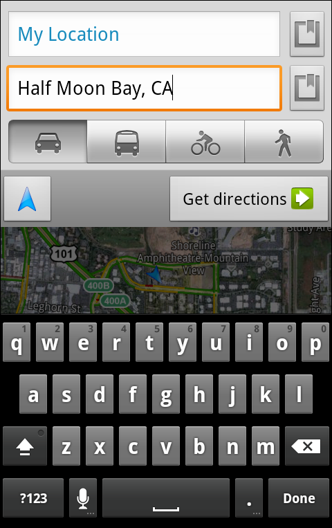
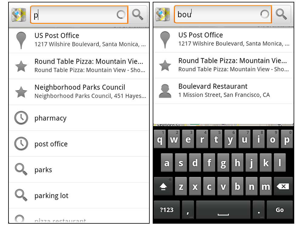
Location Based App Development using Google APIs
Secrets and Surprises of the Google Geo APIs

Week of July 11th
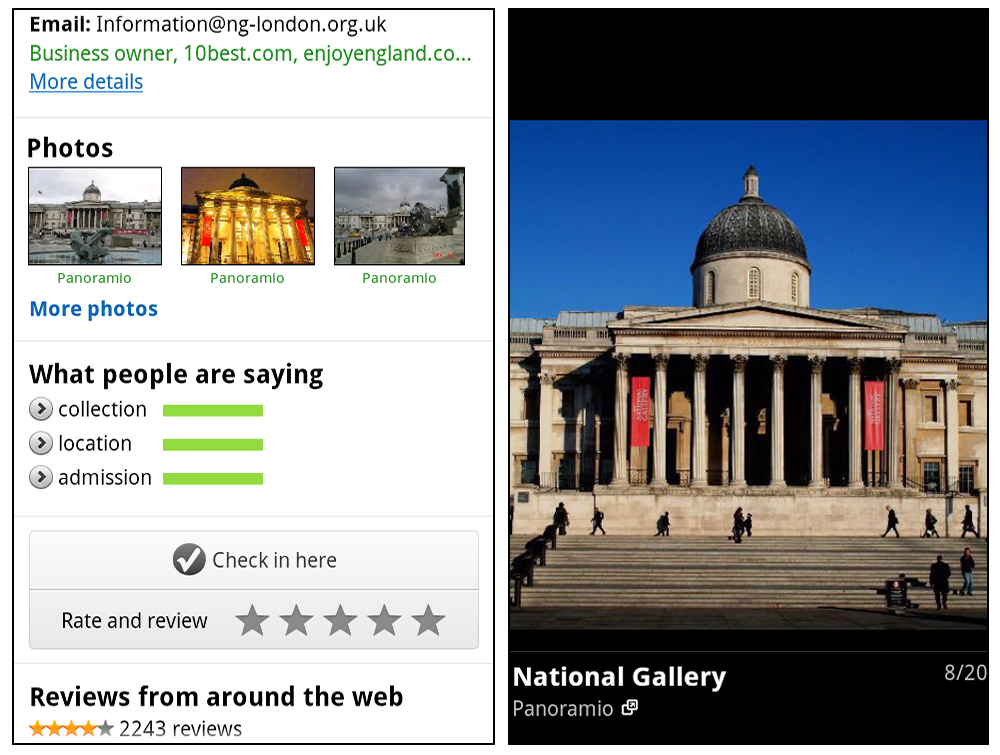
Managing and visualizing your location based data with Fusion Tables
Designing Maps Applications for Usability on Mobile and Desktop

Week of July 18th
High Performance KML for Maps and Earth
Speedy Maps

Week of July 25th
Map your business, inside and out
GIS with Google Earth and Google Maps

If you’d like a head start, videos of all the I/O sessions are linked above. Be sure to visit the Geo Developers Blog throughout July for even more great content from the Maps, Earth, and Fusion Tables teams.


Explore Virtual Kenya

Virtual Kenya is an amazing informational resource, offering materials in wide variety of formats including DVD for those with no internet access. Their goal is to help Kenyans in their educational and professional pursuits by giving them this high-quality spatial data.

The amount of data on the site is very impressive. Along with a variety of tutorials and their blog, they feature over 100 informational maps to give you easy access to their data.

Some of the maps are relatively simple, like their Proposed Small Hydropower Sites:

hydro.jpg

Others are more complex, such as the Average Monthly Rainfall for February map:

rainfall.jpg

Beyond that, they showcase a variety of Google Earth tours on a few different topics. A good example of that is their Wildlife and Tourism Tour, which shows off the country using quite a few different KML overlays and simple 3D models. You can view that tour on their site, using this KML file, or by watching the video below:

In all, it’s quite an amazing site! If you have data to contribute, they have a section of the site full of information on how best to submit it to them.

Google Maps 5.7 for Android introduces Transit Navigation (Beta)

Google releasing Google Maps 5.7 for Android. From Bangkok to Baltimore, they added Transit Navigation (Beta), updated access to directions, better suggested search results, and a photo viewer to Place pages—all of which can help you whether you’re traveling to an unfamiliar part of town or visiting a city across the world.

Transit Navigation (Beta)
Google Maps Navigation (Beta) currently provides over 12 billion miles of GPS-guided driving and walking directions per year. Now, GPS turn-by-turn (or in this case, stop-by-stop) navigation is available for public transit directions in 400+ cities around the globe with Transit Navigation.
Transit Navigation uses GPS to determine your current location along your route and alerts you when it’s time to get off or make a transfer. This is particularly helpful if you’re in a city where you don’t speak the language and can’t read the route maps or understand the announcements. After starting your trip with Transit Navigation, you can open another application or put your phone away entirely and Google Maps will still display an alert in your notification bar and vibrate your phone when your stop is coming up.

Left: Transit directions without Navigation. Right: with Navigation

Navigation alerts appear even if you switch to another app
Now you can spend more time enjoying the sights out the window and less time worrying about how many stops are left, where you are along the route or whether you missed your stop. Since Transit Navigation relies on GPS signals, we recommend using this feature for above-ground transit.

Updated Directions
Now that we’ve improved our directions services, we wanted them to be incredibly easy to pull up on your screen. If you select the driving or walking icon and your route is supported by Google Maps Navigation, the Navigation icon will automatically appear so you can get access to step-by-step directions in one click. Note: this change is currently only in place for driving and walking and does not appear for public transit.

One-click access to Navigation from directions
We’ve also streamlined how you access directions from within a Place page. Before, clicking directions in a Place page would bring up options for “Driving Navigation,” “Walking Navigation” and “Directions.” Now, you’ll be taken straight to the map and see the new directions box shown above.

Improved Search Suggest
We’ve made two changes to search suggestions that improve their quality and speed. First, we’ve added category icons, so instead of all search suggestions displaying the same icon, the icon next to the listing will reflect the type of result. You’ll see a pin for a Google Places listing, a star for a starred Place or location, a clock for a previously used search term, a person for contacts and a magnifying glass for “anything else.”

Two examples of search suggest with new icons
Also, any place you got directions to or called directly from its Places page will be included as a suggestion for a relevant search. For example, if you recently received directions to the U.S. Post Office on Wilshire Boulevard, afterward, when you begin a search with [p] or [bou], that U.S. Post Office would appear as a search suggestion.

Photo viewer for Place pages
Since we released business photos for Place pages last October, millions of photos have been added to Place pages around the world. To enable you to view these photos on the run, a slick new photo viewer has been added so you can browse photos while deciding where to go.

Left: Business photos in Place pages. Right: New photo viewer
To start using Google Maps 5.7 for Android, download the update here. This update requires an Android OS 2.1+ device and works anywhere Google Maps is currently available.